
A flat map leaves out the climb
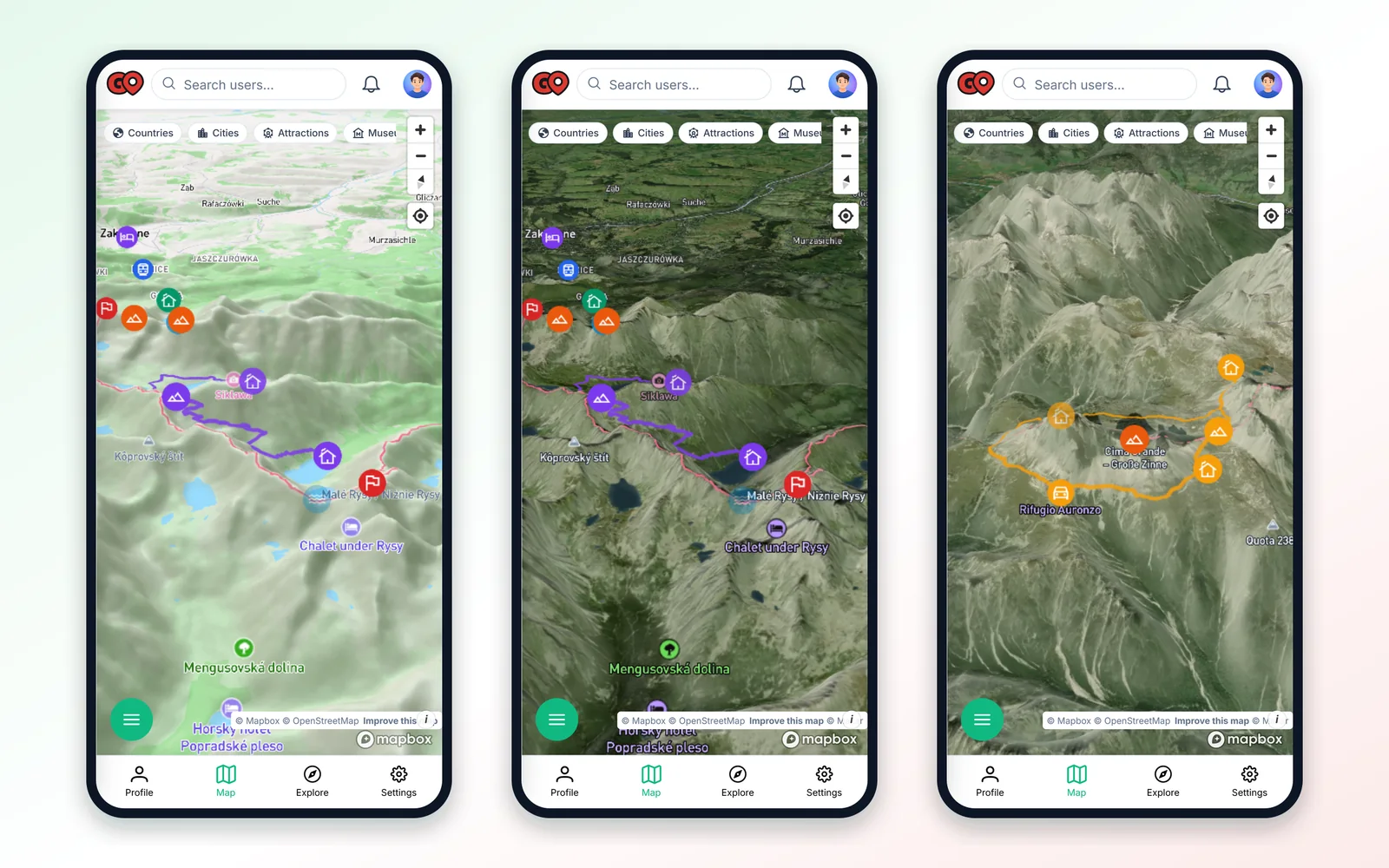
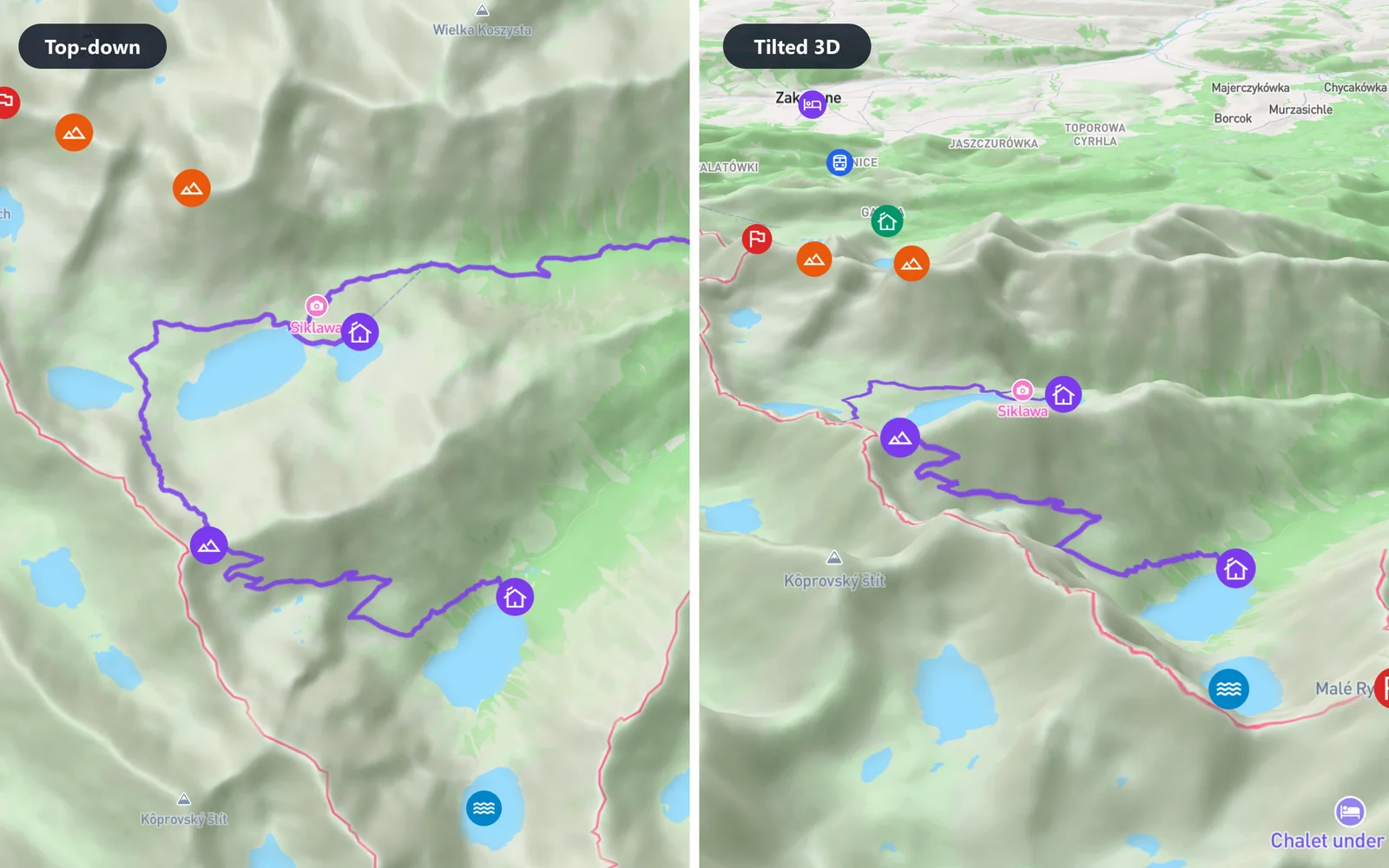
On a flat map, a hut and a pass can look like neighbours. The terrain shows the few hundred metres of climbing between them. In MapiGO, you can view your saved places on a 3D map and see where the valleys and ridges run.
The examples come from a July trip to the Tatras and a plan for the Dolomites in September 2027.
Switch to a 3D map style
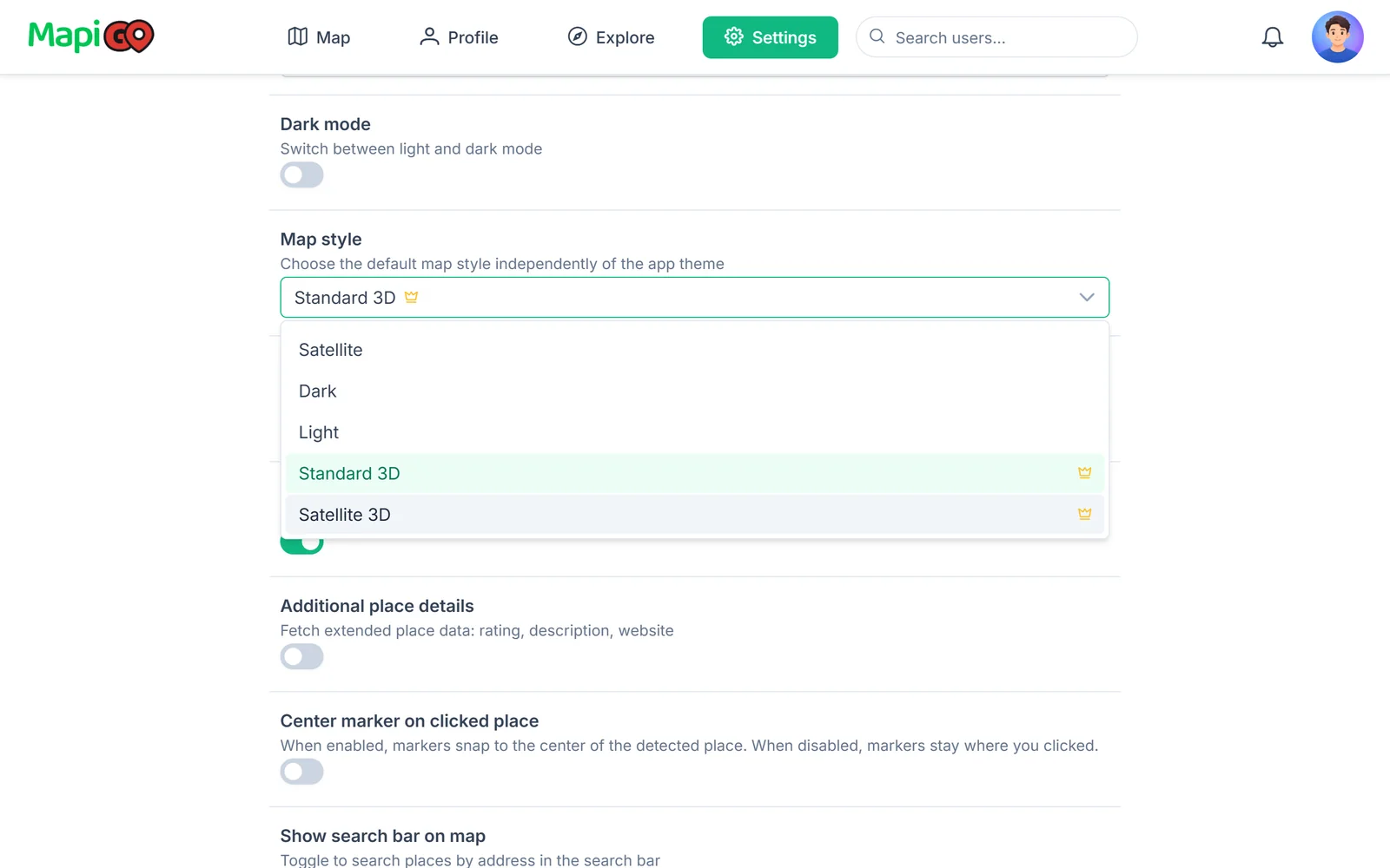
In Appearance settings, choose Standard 3D or Satellite 3D as your map style. 3D styles are part of the Premium plan.
On a computer, tilt and rotate the map by dragging with the right mouse button or while holding Ctrl. On a phone, move two fingers up or down. The compass button turns the map back to north.
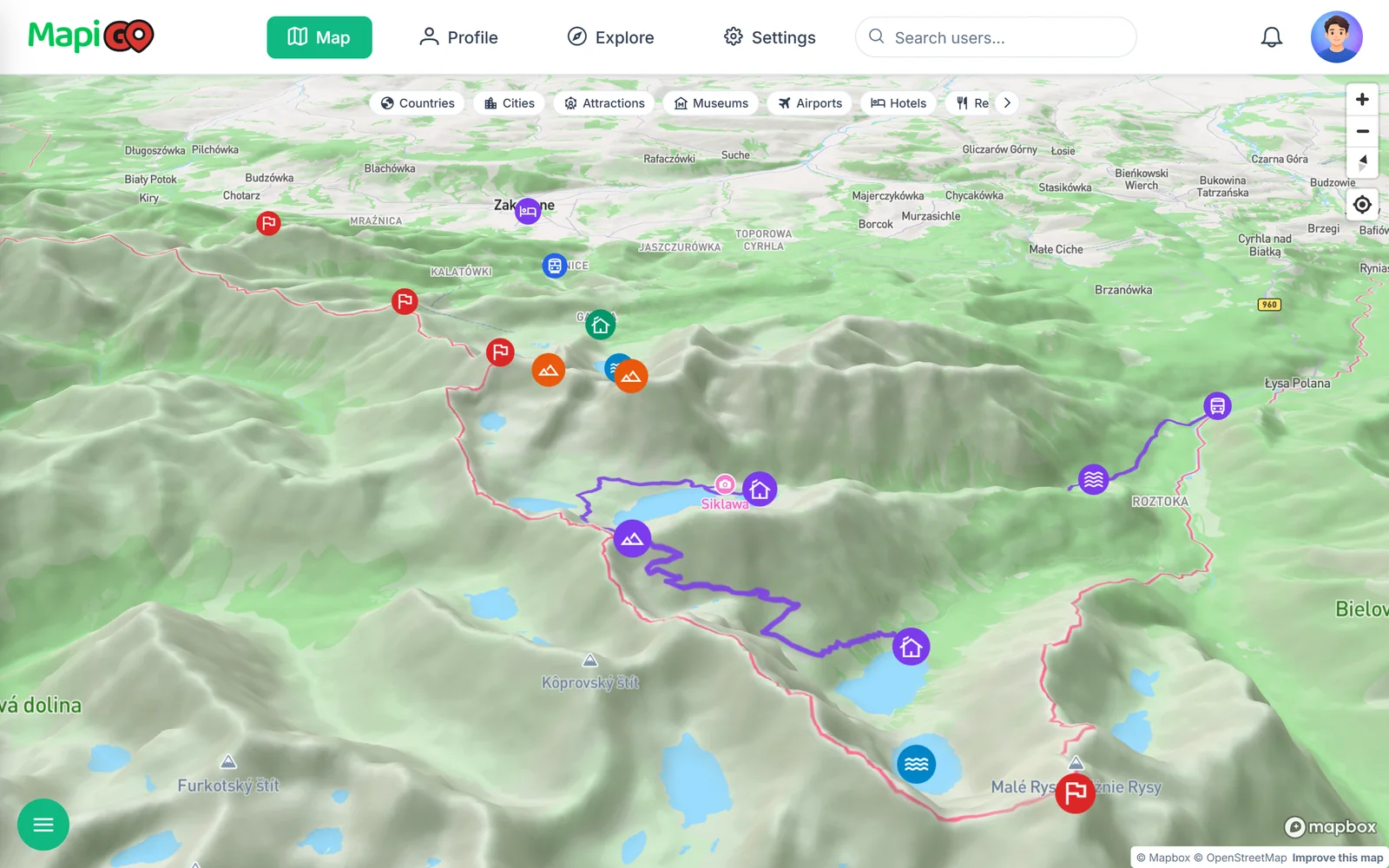
Standard 3D with peak names
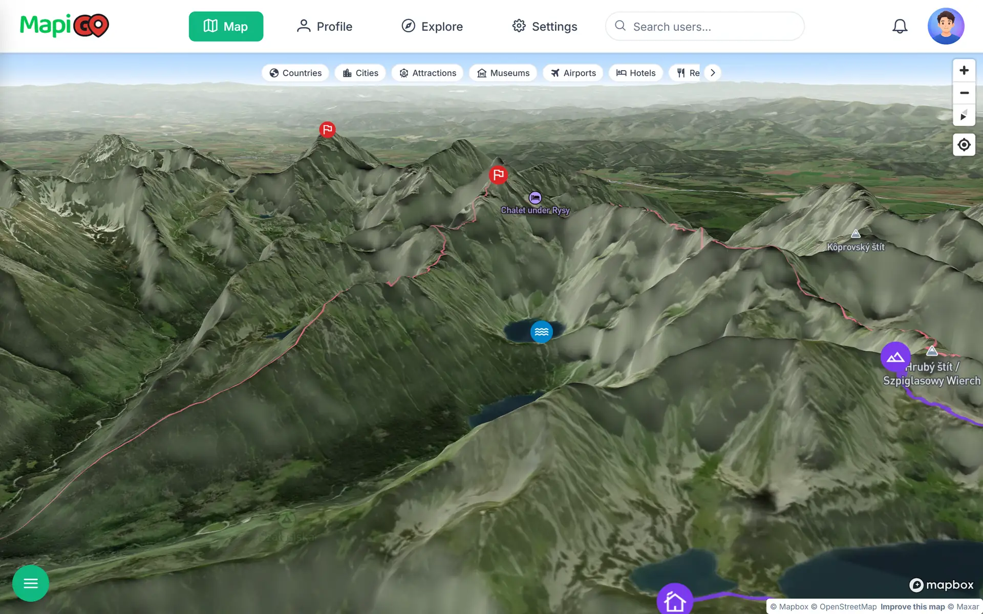
Standard 3D combines the shape of the terrain with the names of peaks, lakes and huts. With the map tilted, you can see where a trail enters a valley and where the climb to a pass begins. Markers stand out clearly against the slopes.
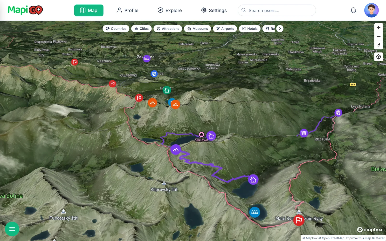
Satellite 3D
Satellite 3D shows rock, scree, the tree line and lakes. It helps you judge whether a section runs through forest or across an open slope.
Satellite images may be several seasons old and will not show current snow or closed trails. Check national park notices and the weather forecast for current conditions.
Mark peaks, passes and huts
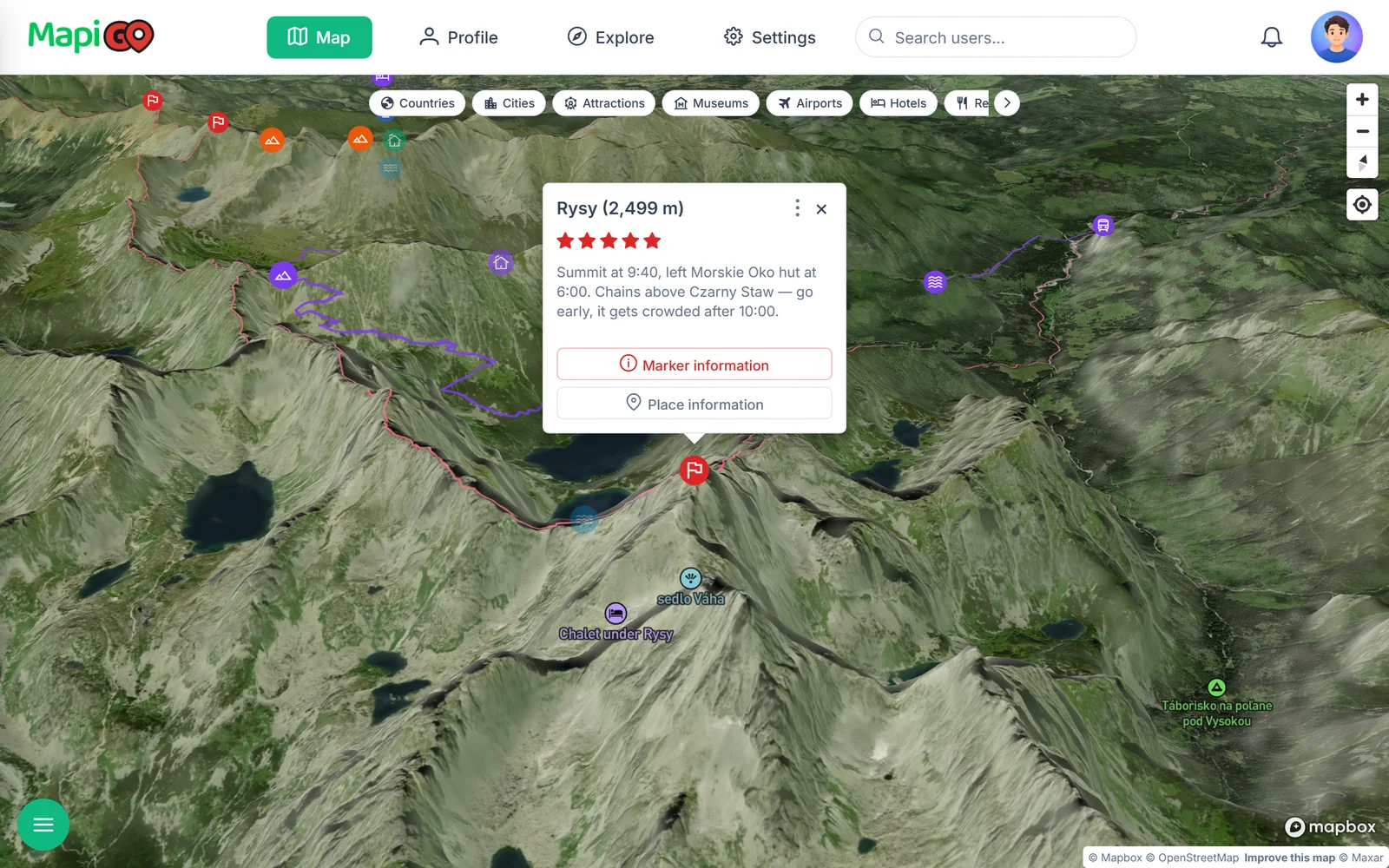
Give peaks and passes the Mountains category and huts a category of their own, such as “Mountain huts”. Add the elevation to the name, for example “Rysy (2,499 m)”, so it shows straight away in the marker popup.
After the hike, add the date, a rating and a note. Specifics help most: when you left the hut and where the chains began.
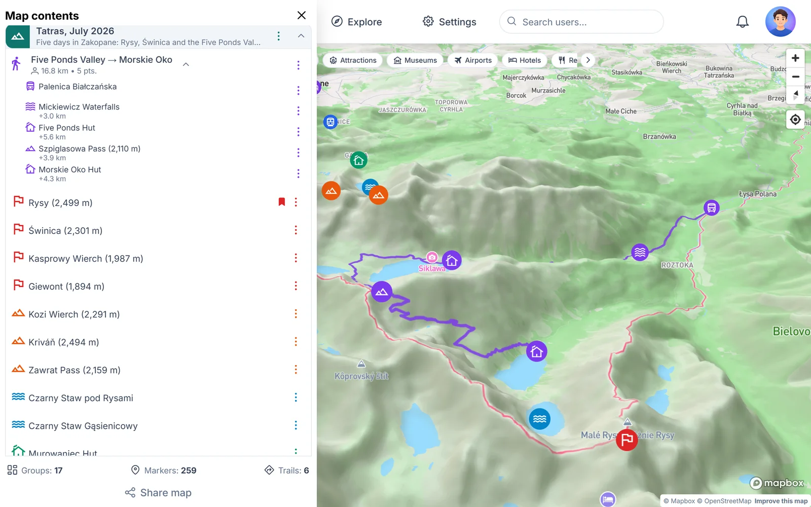
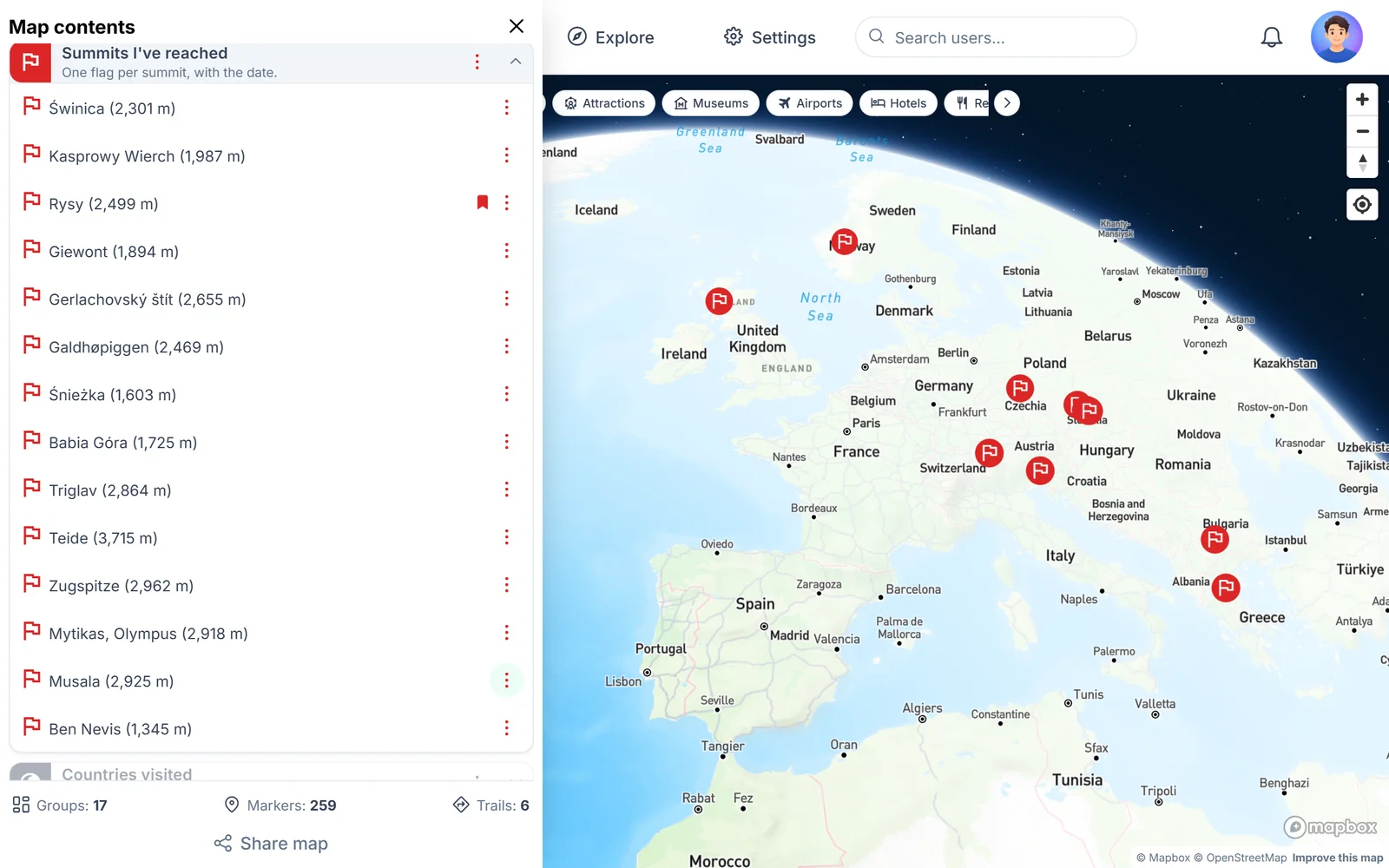
On the example map, summits you have reached use a red flag icon. Peaks saved for another time get an orange mountain icon, and huts a green cottage. Zoom out and you can see at once what is still left to climb.
Draw the hike as a trail
Click the starting point, choose Add trail and the walking mode, then mark the next points: car park, hut, pass. MapiGO draws the line along paths and shows the length of each section and of the whole trail.
In the mountains, walking time depends on the climb as much as on the distance. Copy the times from trail signs or a guidebook into the point’s note.
A plan for next season
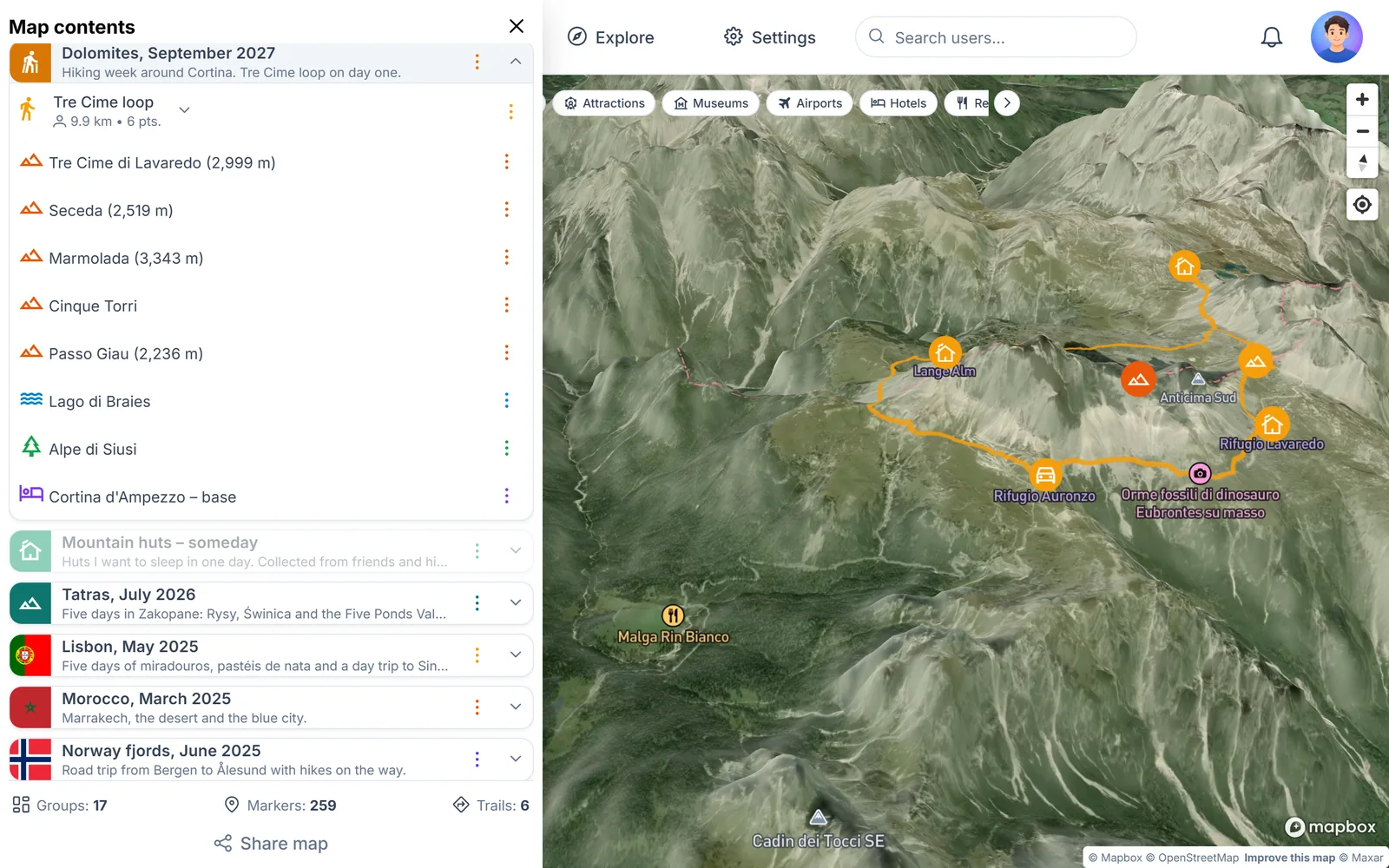
A group called “Dolomites, September 2027” collects peaks, lakes and a base for a future trip. The loop around Tre Cime is already drawn, so you can check its length and plan a break at a hut.
Satellite 3D shows the trail circling the massif. The summits themselves are reached by climbing routes.
A list of summits you have reached
A separate group can collect summits from different years and ranges. A marker can belong to more than one group, so Rysy can be part of your Tatras trip and your summit list at the same time.
Zoom out to see all the flags at once, from Ben Nevis in Scotland to Teide on Tenerife.
On the trail with your phone
The 3D map works on your phone too. Tilt it with two fingers to look over the valley before you leave the hut.
MapiGO does not replace a hiking map or navigation. Mobile coverage can be poor in the mountains and batteries drain quickly, so carry a paper map and check the forecast before you set off.