

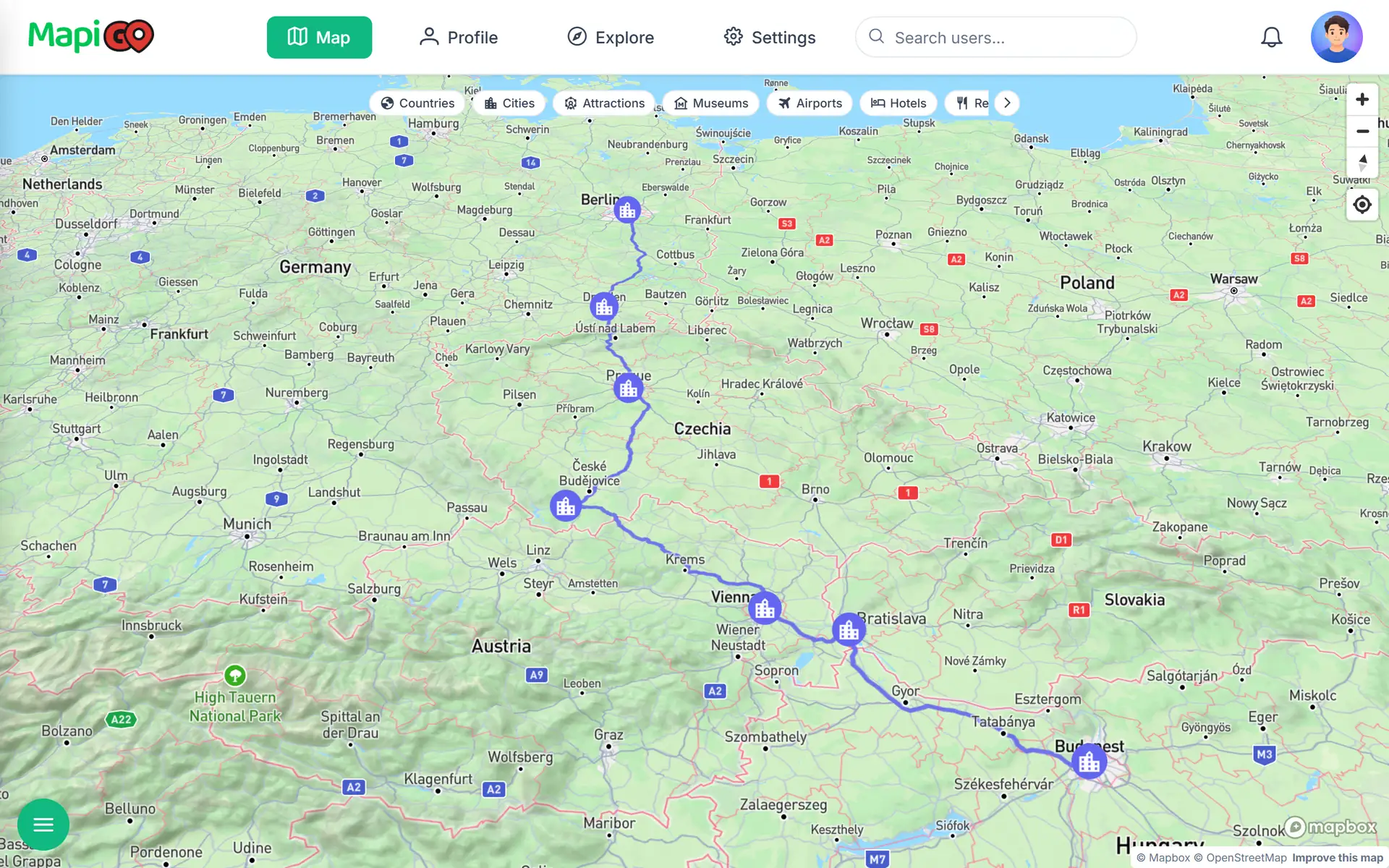
The route in numbers
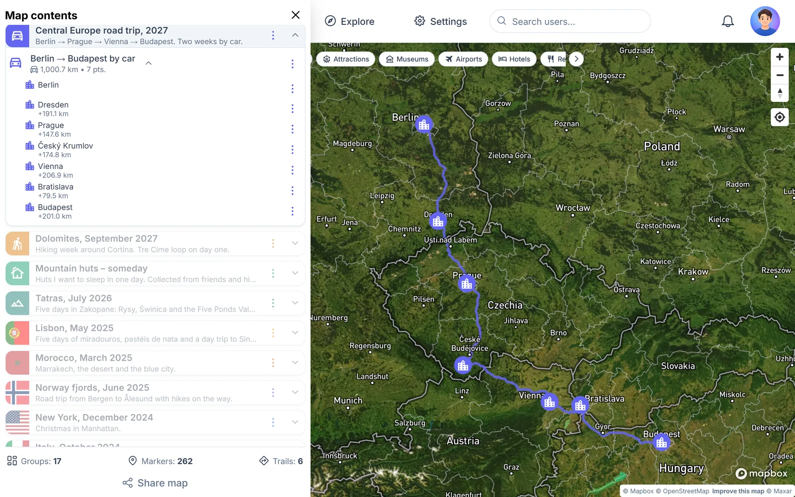
The example plan starts in Berlin, where the rental car is collected, and ends in Budapest. On the way are Dresden, Prague, Český Krumlov, Vienna and Bratislava. MapiGO puts the whole route at 1,000.7 km.
Berlin to Dresden is 191 km, Dresden to Prague 148 km and Prague to Český Krumlov 175 km. The longest stage, from Krumlov to Vienna, is 207 km. After that it is 79 km to Bratislava and 201 km to Budapest.
Where to spend the nights
The plan has three nights in Prague and three in Vienna. Dresden is a lunch stop with a walk to the Frauenkirche, since Prague is less than two hours’ drive from there.
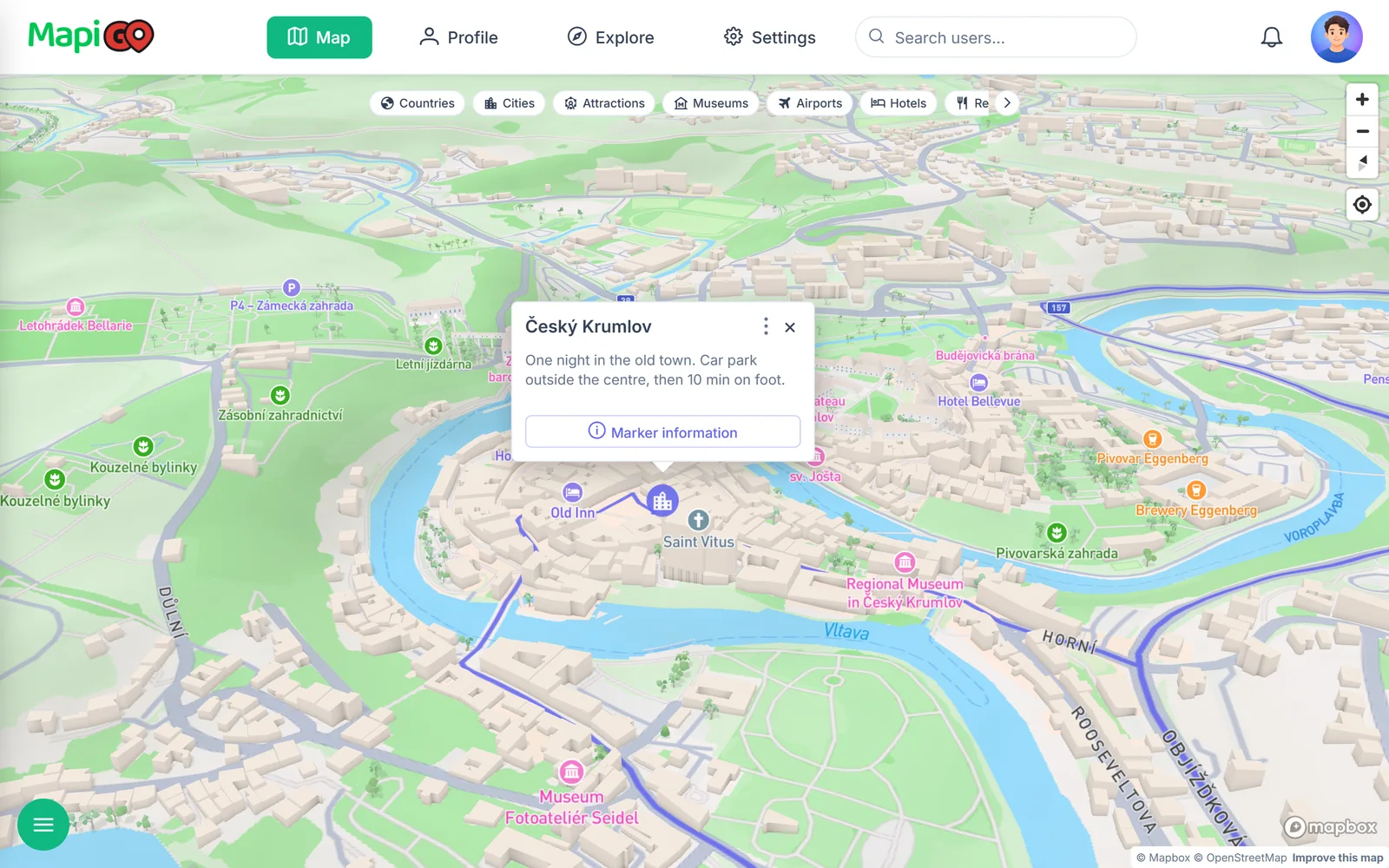
Český Krumlov is worth an overnight stay. Most of the historic centre is closed to cars, so the car stays in a car park outside the old town. In the evening, once the day trippers leave, the lanes get much quieter.
Vignettes and the rental car
Cars use German motorways free of charge. Czechia, Austria, Slovakia and Hungary all require a vignette, even if you are only passing through.
The Czech, Slovak and Hungarian vignettes are electronic and linked to the number plate. Austria offers a digital vignette or a sticker. A digital Austrian vignette bought online by a private customer only becomes valid on the 18th day after purchase, so do not leave it for the night before.
Buy vignettes from the operators’ own websites: edalnice.cz, eznamka.sk, ematrica.nemzetiutdij.hu and asfinag.at. Resellers usually add a fee. Prices change every year, so we do not list them here.
Ask the rental company for permission to drive in all four countries and about the fee for returning the car in a different country.
Vienna without the car
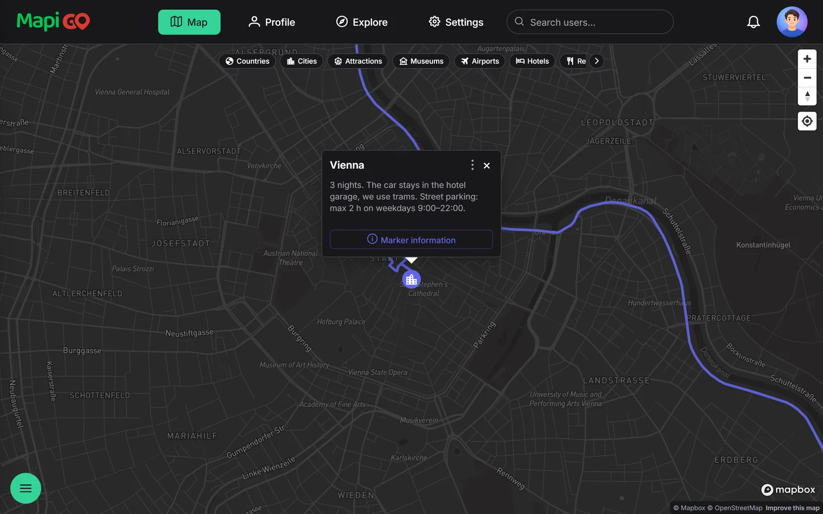
Since March 2022 the whole of Vienna has been a short-stay parking zone. On weekdays from 9:00 to 22:00, without a resident’s permit, you can park on the street for two hours at most. For a three-night stay it is simpler to leave the car in the hotel garage and use the trams.
Keep details like this in the stop’s note. The popup for the Vienna point shows it straight away, without opening the details.
The whole route on one map
In MapiGO, click the starting point, choose Add trail and the driving mode, then mark each city in turn. The line follows the roads, and every point shows the distance from the previous one.
The route belongs to the trip’s group. You can add ordinary markers to the same group, such as a restaurant in Prague or thermal baths in Budapest. If you change the order of the cities, check the stage lengths again: one detour can add an hour of driving to a day.